


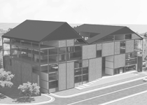


Alexandrina Library
Science City competition 2016
Team
:::Ahmed Al Antably
:::Anais Mikaelian
:::Ezz Abou Auf
:::Hunia Tomoum
:::Laila Selim
:::Mohamed Yassin
:::Pakinam El Shennawi
The Science City exists manifestly in a trialectic relationship with its patron the Bibliotheca Alexandrina and with its imposing neighbor the Great Pyramid. At one level, this is a relationship between a library, a science park, and a tomb; a relationship between knowledge, its application, and death and resurrection; a relationship between today, the future and the ancient past.
At a hermeneutic level, a careful reading of our proposed design against the physical expressions of both the Bibliotheca Alexandrina and the Great Pyramid offers many nuances. We propose a cube constructed against the slanted cylinder of the Bibliotheca Alexandrina and the Pyramid at Giza. When reduced to their basic geometrical elements, these three architectural expressions are the most ancient and elementary of all symbols: the circle, the square and the equilateral triangle.
The circle is the disk of the sun, the dome of the sky, the planets orbiting the sun, the circle of life. It is nature at all its glory as understood by the ancients. The pyramid, for ancient Egyptians, is the symbol of creation (the original pyramid-shaped mound, the benben, from which life emerged), and a symbol of death and resurrection (the burial tombs in Giza).
The square is the symbol of humanity's interference in nature: It does not exist naturally. It can only be constructed by humans. For the ancient Greeks, the square is the "natural" way for humans and their relation to the physical world. There are four directions and four seasons. We use a four-sided keyboard and a four-sided computer screen to produce (print) a project on eight four-sided panels.
Based on the work of the Roman architect Vitruvius, the perfect geometric forms are the circle and the square. The circle was taken to represent the spiritual realm and the square to represent the material realm. The human body, for Vitruvius, with his arms and legs extended, fits into two concentric shapes: a circle and a square. The result is a perfect geometry that represents both the spiritual and material aspects of humanity. The superimposition of the square on the circle or "squaring the circle" has since been a principal source of the production of proportion systems in classical architecture. The superimposition of the two shapes with the same areas was understood to produce the Golden Division.
The history of technology can be seen as the history of humanity trying to master nature. One expression of this mastery over nature is the production of the perfect square. Technological advancements are linked to higher precision in industrial production. Precision tools (for example, CNC machines) are aimed at the production of precision squares. The more precise a square is, the more alienated it becomes from nature, the more it comes closer to humanity's dream of mastering nature. The squarish monolith in Stanley Kubrick's 1968 movie 2001: A Space Odyssey represents active knowledge that induces technological development of humanity.
As such, our proposed cube (square), the Observatory, exists in a trialectic relationship with the Bibliotheca Alexandrina and the Great Pyramid. Its purpose is to negotiate a formal relationship with its patron, the cylindrical (circle) library in Alexandria and monitor its neighbor, the Great Pyramid (triangle).
The Hike

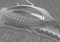
The Observatory is designed as a perfect cube to act as a landmark for the Science City and for the entire neighborhood. Externally, it is negotiating its presence with the Bibliotheca Alexandrina and the Great Pyramid. Internally, it is entertaining the relationship between nature and artificiality, between humility and monumentality, between natural sciences and their technological applications. It stands as the formal and conceptual contrapuntal manifestation of the Science Park.
Science is the systematic study of the phenomenon of life in all its manifestations (nature). Science is the acquisition of knowledge through observation and experimentation discovery. Our proposed Science Park is designed as a discovery trail a hike.
Hikers move between nodes (circles) of knowledge, oases in a physical and intellectual desert. At the center of each is knowledge, sedentariness, lush greens and plentitude; at the periphery, ignorance, mobility, aridness, desert and scarcity. Architecturally, the Hike is embedded in the fluidity of the park flow. Nodes are carved out of the landscape to form pits, sunken plazas of knowledge. Hikers start their discovery journey at the Orientation Hall and follow the trail into the elevated Science Park. They move among outdoor exhibits and descend into the sunken plazas to visit thematically organized nodes.
The Social Life of Nodes

Science and technology, like almost any other human activity, are socially constructed and produced. The progress of science and technology is inevitably linked to and formed by the conditions of the society in which they are produced. This is the basic argument that AnnaLee Saxenian used in her convincing explication of the success of the decentralized structure of California's Silicon Valley and the failure of the vertically integrated structure of the Massachusetts' Route 128. The success of the structural model of Silicon Valley is based on an ecosystem that encourages scientists to work on research projects for relatively short time and then move to another project with their accumulated knowledge from previous projects in a creative and interdisciplinary environment.
Following Saxenian's argument, we decentralized the structure of the park to allow for more mobility and interaction between ideas, scientists and the public. We organized the park thematically into three main nodes and eight sub-nodes. These thematic nodes form the structural base of the Hike but also the basis of the phasing and future expansion of the project as we will show later.
The three main nodes are the Orientation Hall, the Conference Center and the Observatory. We combined the Observatory and the Planetarium in one building because they complement each other thematically. These three main nodes are directly connected, for visitors with a special interest to attend a specific event, and leave. Otherwise, there are alternative hiking routes, which are longer walking distance.
The eight sub-nodes are the product of the reorganization of the Research Center, its laboratories, and indoor and outdoor exhibition spaces into eight different themes following departmental collections: (1) Fauna, (2) Flora, (3) Archaeozoology, (4) Archaeobotany, (5) Sediments and Soil, (6) Geology, (7) Microbiology, and (8) Anthropology. Nodes and sub-nodes are connected by two types of routes. For the inquisitive visitor, there is the hiking trail. The staff or the task-oriented visitor can opt to use a more straightforward route.
The Method


We used computational methods for the development of the form for the Science Park. The site originally slopes slightly upward towards its north-eastern side building up a difference in height that can reach 10 meters. We translated the contour lines into field lines emulating a force field covering the whole site. We then organized both nodes and sub-nodes as centers of forces affecting the force field. Nodes, understandably, exercised stronger forces than sub-nodes. The resulting deformation of the field lines were thus transformed into deformation of the site's contour lines. The aforementioned method reinforced our interpretation of the Science Park's nodes and sub-nodes as a network of outdoor sunken urban plazas surrounded by thematically organized departments.
Programatic Development


The resulting thematic plazas are the interface between the public and scientists. With its sunken structure and heavy plantation, the plaza affords lots of canopies for outdoor interaction. Most plazas have a cafe that serves both the public and the resident scientists. The scientists' lounges are overlooking the plaza and are accessible by the public. The setup opens the department for the exchange of ideas amongst scientists but also amongst scientists and the public.
Phenomenologically, the sunken plaza visually isolates its dwellers from the rest of the site, with the exception of the Observatory. From one hand, it helps hikers focus and hopefully immerse themselves in the plaza's activities. From the other hand, it hides other elements of the park, building up anticipation and a sense of discovery.
Environmentally, a sunken plaza with an abundance of softscape canopies provides better thermal comfort to its dwellers in an arid climate. The earth-sheltered departments surrounding the plaza with planted rooftops (the park) take advantage of the earth as thermal mass. The change in the earth temperature occurs much slower than conventional building materials, creating a thermal lag. The earth, as such, protects the indoor against fluctuation of outdoor temperature, saving on energy spent for cooling or heating the indoors.
Feather to Desert


Feather to desert is an approach to landscape design that is derived from the pattern of human habitation in the desert. Humans settle near water supplies to plant their food and horde their cattle. Vegetation is thriving at the center, near the water supply, and degrades towards the periphery until it surrenders to the desert. When water supplies are too close, they connect and form a greater area of vegetation. To enrich the hiking and discovery experience, most of our proposed vegetation is edible. Instead of just watching the landscape or enjoying the shade of its canopies, hikers can also taste the vegetation. Beside its edibility, the choice of vegetation was also based on its suitability for the sandy soil of the site, and its authentic Egyptian character. No where in the landscape we use lawn.
At the center of each node -the oasis- is the sunken plaza. At the plaza, we propose the plantation of fruit trees that offer food for users in different seasons, but also a rich canopy and sometimes a distinct aromatic experience (e.g., mandarin, orange, apple, olive, etc.). On the rooftops of buildings immediately outside plazas, we propose vines, vegetables and herbs (e.g., tomato, pepper, mugworts, etc.) As hikers move away from the nodes, they explore desert vegetation (e.g., date palms, barbary fig, etc.). Eventually, once the hike is completed, the user should have experienced and hopefully learned about the flora and fauna of the Egyptian countryside.
The Tower

The tower is part of our thematic reorganization of the program. Initially, it houses the Observatory and an Astronomy department. We propose to integrate the Planetarium into the tower.
Programmatically, the Planetarium complements the theme of astronomy housed in the tower. Architecturally, the Planetarium breaks the monotony of the proposed Observatory and complements it. The cube acts as an external landmark for the site, its neighborhood, and potentially the whole Egyptian cultural and scientific scene as it connects to the Bibliotheca Alexandrina and to the Great Pyramid. The Planetarium acts as an internal landmark within the Observatory. It is a reflective metal-cladded capsule engraved in the Observatory's cube. It puzzles the hikers about the nature of its function and gives the cube a sense of direction.
Street Access and Circulation

The current access to the site is inadequate. The main approach is from al-Wahat road, south of the site. However, no direct access is available and visitors instead would have to navigate a maze of poorly paved roads in order to reach the site. We propose a direct access to the site from al-Wahat road. With the proposed Observatory acting as a landmark, visitors approaching the site can easily identify and access the site.
Once in the premises of the site, visitors approaching in their private cars are welcomed with a large parking lot. Staff or visitors of the Conference Center can alternatively take a ring road to drive all the way to their destinations. Visitors approaching the site in buses can park at drop-off points near the main entrance. Buses can then proceed to park in remote location until pick-up time.
Phasing and Future Expansion

Nodes constitute the basis for the phasing of the project. Nodes representing the Orientation Hall, the Conference Center, the Observatory Tower and the Planetarium, the Flora Department, and the Anthropology Department are scheduled for Phase 1. During this phase all the programmatic requirements for this phase are met. Administration departments and technical units are housed in temporary locations within the tower and the departments.
Nodes representing the central administrative departments and technical units, the Fauna Department, the Sediment and Soil Department, and the Geology Department are scheduled for Phase 2. At this phase the administrative departments and technical units can be relocated to their permanent locations.
Phase 3 comprises the nodes for the Microbiology Department, the Sediments and Soil Department, and the Geology Department. Upon the completion of Phase 3, the project built up area will reach 31,768.79 square meters. The maximum built up area according to regulations is 37,498.44 square meter. This leaves room for two more nodes for future expansion.


